Safe Streets 4 All Dashboards

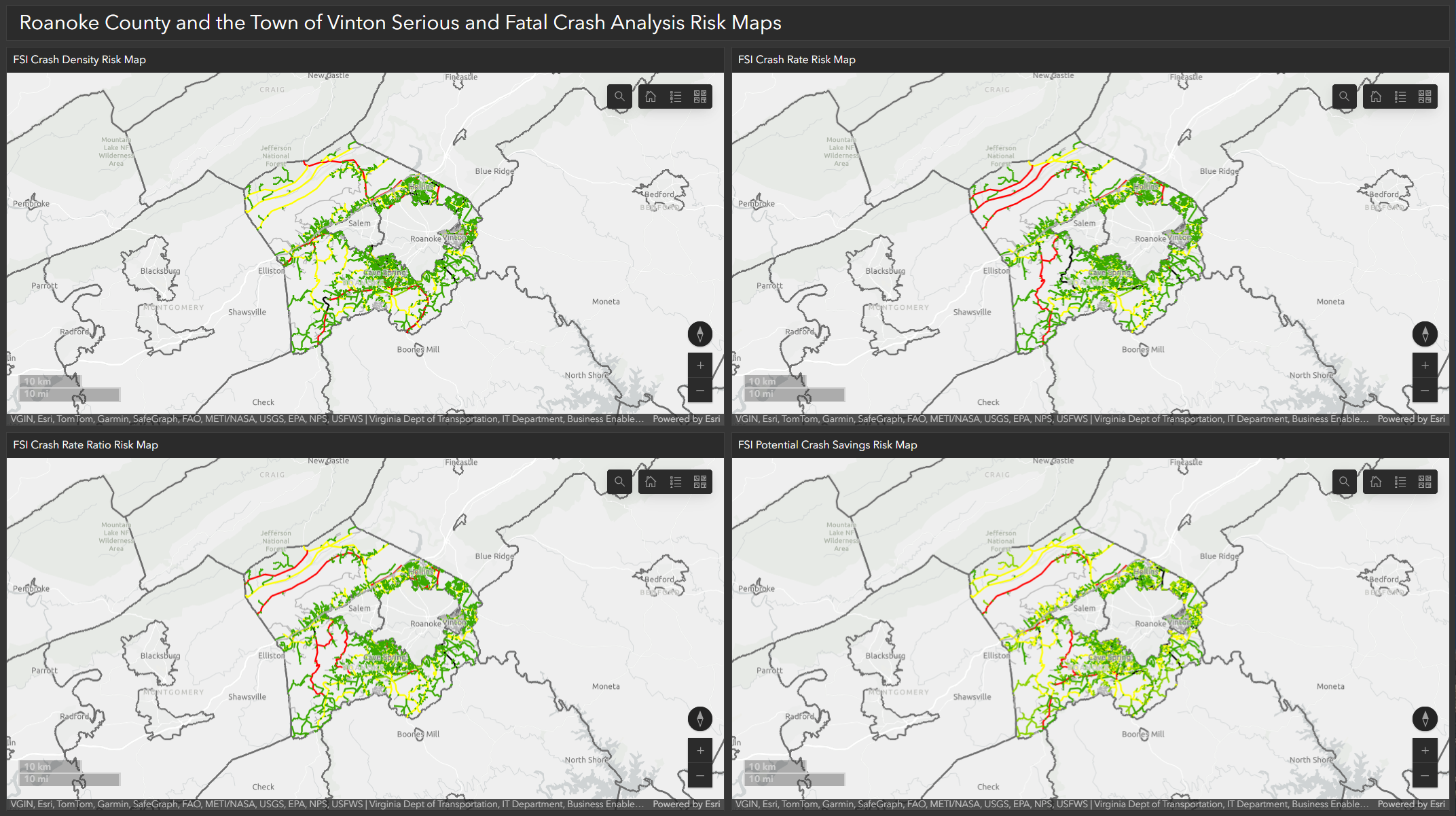

Roanoke County, Botetourt County, and the Town of Vinton were successfully awarded a grant through the U.S. Department of Transportation’s Safe Streets and Roads for All (SS4A) Discretionary Grant Program to develop a Comprehensive Safety Action Plan. The purpose of the SS4A program is to help communities improve safety by significantly reducing roadway-related fatalities and serious injuries.
These Dashboards display fatal and serious injury crash data, visualized along with vital attribute data to provide users the ability to derive valuable insights and inform future decision making.
View Roanoke County SS4A Dashboard →
View Botetourt County SS4A Dashboard →
Statewide Caltrans Culverts Inspection Program (CIP) Dashboards Series

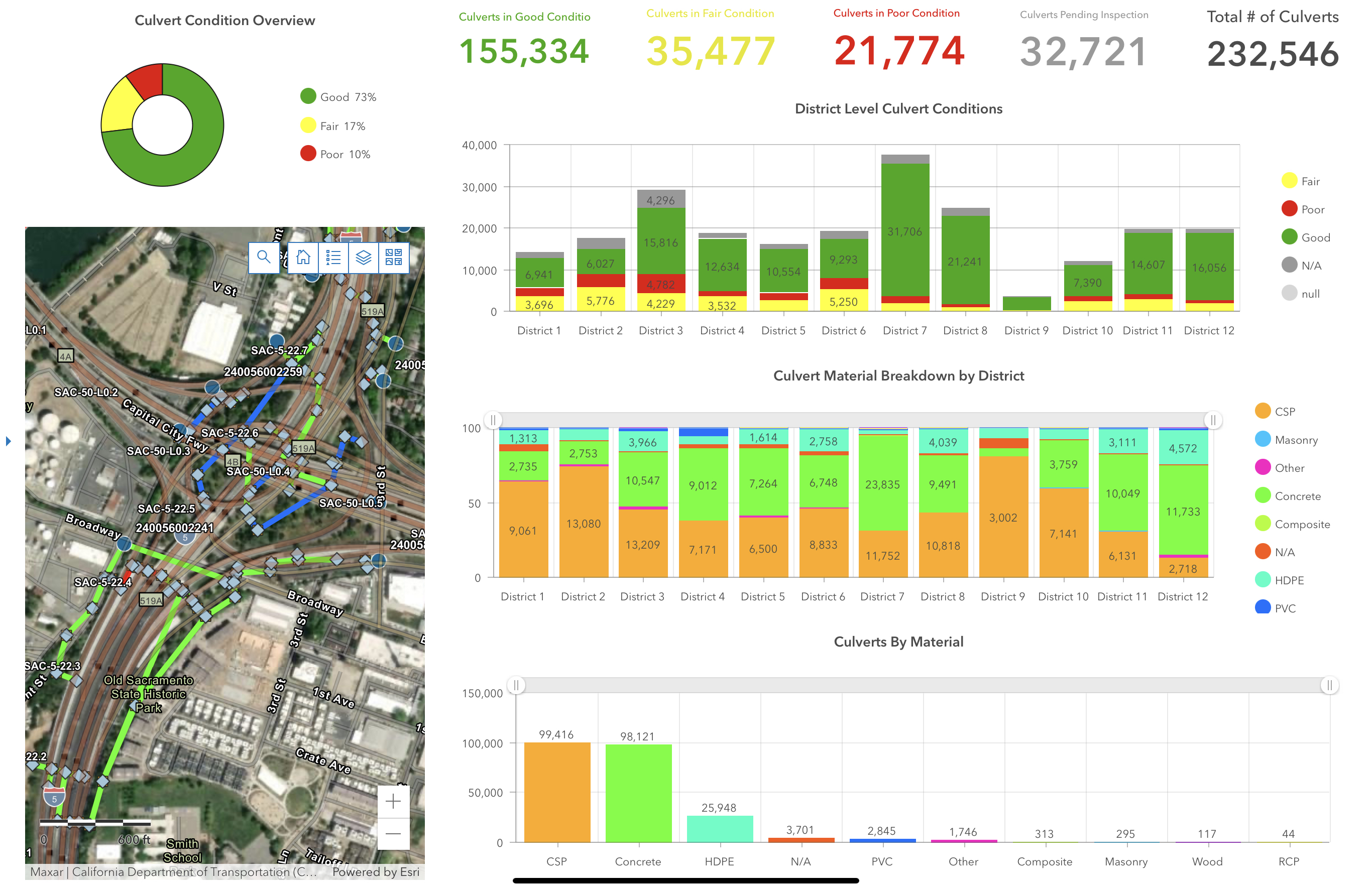
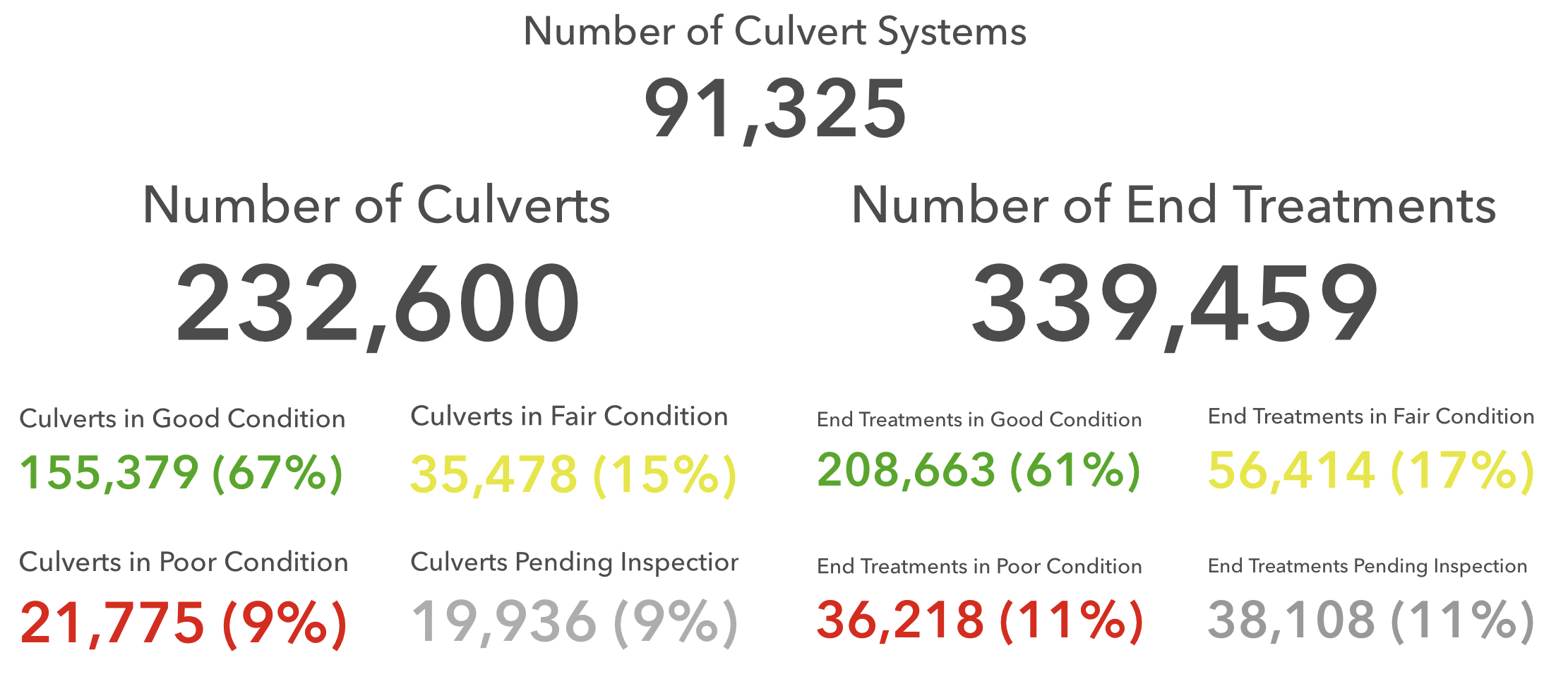
This series of dashboards are used to report on a variety of metrics collected by the Caltrans Culverts Inspection Management System (CIMS) for the Caltrans Culverts Inspection Program (CIP). These dashboards reference a single read only map service that is published from DEFAULT as the enterprise geodatabase is set to be branch versioned. In fact, multiple services have been authored from DEFAULT to facilitate the maintenance and exploration of the program’s data.
